NARRATOR: Hi, everyone. Today I'm going to be talking about traditional Polynesian navigation and voyaging. Now, in case you don't know, the Islands of Polynesia are in the Pacific Ocean and include Hawaii, Tahiti, and Samoa.
All of these islands were originally uninhabited by humans, and for many years there was a debate about where the Polynesian people had migrated from. It was once suggested that they came from the Americas. However, that debate has been settled.
Today, anthropologists recognize that the Polynesians 1began their journeys in Asia and from there migrated eastwards to the Pacific Islands. It is believed all the Polynesian Islands had been settled by the 13th century. When European explorers arrived in the Pacific in the 17th and 18th centuries, they were impressed by the local canoes. European ships were much stronger, but the Indigenous vessels were 2considerably faster when under sail.
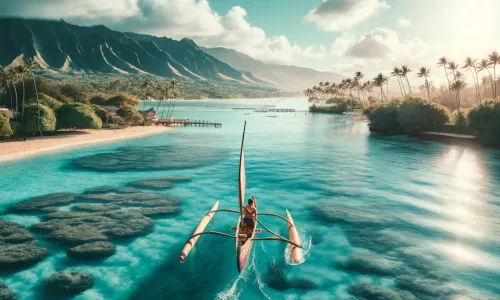
What we now know is that Polynesian sailed across open ocean, out of sight of land long before this occurred elsewhere. And to make these voyages possible, they built remarkable oceangoing canoes. The canoes had two holes, so are sometimes called catamarans. They were equipped with large paddles, but these were not a form of propulsion. Instead, the paddles were positioned at the back of the canoe to make 3steering the vessel possible.
All these ocean going canoes had sails. Polynesian sails were triangular in shape and made from the pandanus plant, which grows on nearly all Pacific Islands. It was also necessary to make warm clothing, as even in tropical waters, people could get cold on long voyages. Materials like wool and cotton were unknown to Polynesians. However, the paper mulberry tree growth on most Pacific Islands, and its 4bark was remarkably flexible and was used in the manufacture of clothing.
Next we come to the issue of navigation at sea. How did Polynesians find their way once they were out of sight of land? We know that they did not have the magnetic Compass, which told other navigators which direction was north. But the Polynesian navigators understood where numerous stars rose and set on the horizon. And using this, they could identify 32 different directions. However, this information about the stars was extremely complex and therefore remembering it all was a challenge. So the navigators had created 5long and complicated songs to help them recall all the information they needed.
Using the stars to navigate was effective so long as the sky was clear. But when it was cloudy, the navigators couldn't see the stars. How did they find direction, then? Well, they still knew which way to sail the canoe by studying the 6waves, which usually came from predictable directions in the Pacific at different times of the year.
Sometimes they were sailing between Islands they had visited before, but very often they were trying to find new Islands. How did they know that land was nearby just over the horizon? Well, there were various techniques. The navigators were experts at recognizing those particular 7birds whose habitat was the open ocean and those that lived close to Islands. So this was one way they knew that land wasn't far away. They were also skill-noticing changes to the sea itself. The temperature of the water is constant in that part of the Pacific, but its 8color could vary in the proximity of land. And that was something else that they were able to detect.
Well as technology developed, traditional voyaging orbit died out. The Polynesian Peoples traveled by steamship and later aeroplane. Like everyone else. However, in recent history there has been renewed interest in traditional voyaging. It began in 1976 when a new canoe named Hokulea was built as a replica of traditional Polynesian vessels. This canoe was sailed from Hawaii to Tahiti, a distance of more than 4000km across open ocean, and all the navigation was done using the techniques I've outlined today. The crew 9did not use modern instruments on the voyage. Since then, there has been a remarkable Renaissance of traditional voyaging. Numerous canoes have been built in different Polynesian countries, which have sailed to almost every part of the Pacific, and the Hokulea has now completed a three year circumnavigation of the world. As well as sailing, these voyages have sparked renewed interest among Polynesians in learning about their traditional cultures. The canoes themselves operate as floating classrooms, teaching young people about, for example, the music their ancestors once enjoyed. Another aspect of this has been the teaching of 10Polynesian languages, some of which were in danger of dying out. Now, one thing I'd like to add is...